
The highest mountain peak in the Balkan Peninsula is Peak Musala in the Rila National Park in Bulgaria, with an altitude (counting from the sea level) of 2,925 meters or 9,598 feet and a topographic prominence (counting from its foothill) of 2,473 meters or 8,114 feet. To bring things into perspective, the highest peak in the Smoky Mountain National Park, stretching across North Carolina and Tennessee, is Clingman’s Dome, with an altitude of 2,025 meters or 6,643 feet and a topographic prominence of 1,373 meters or 4503 feet. It is often chilly at Clingman’s Dome when the fall foliage turns color around mid-Oct. It would be even colder at Musala around that time since it’s taller, so we thought of hiking to Peak Musala as soon as possible when it would still be relatively warm.
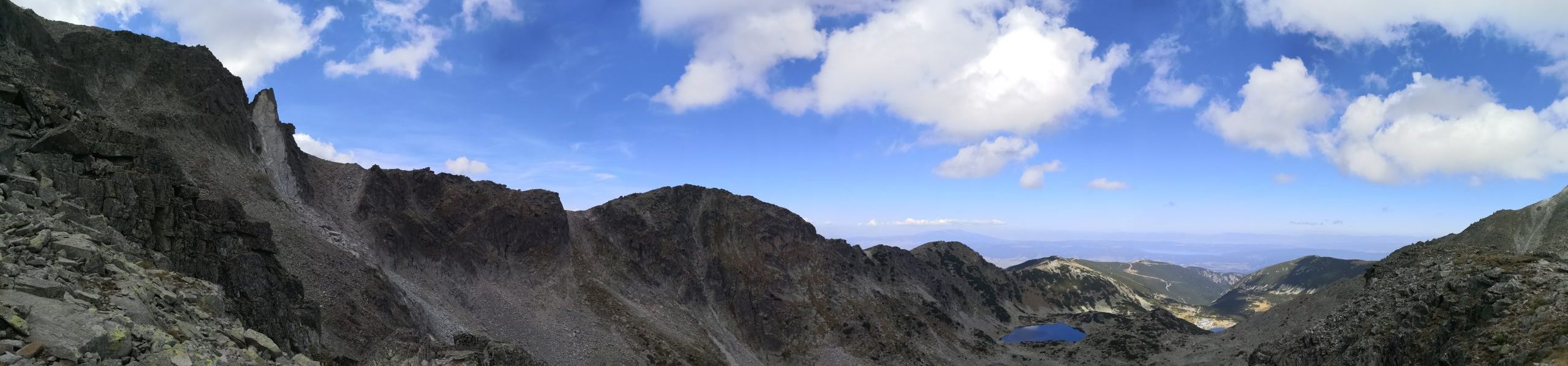
We took a day trip to Peak Musala (МУСАЛА) this weekend, and the view was spectacular and other-worldly.
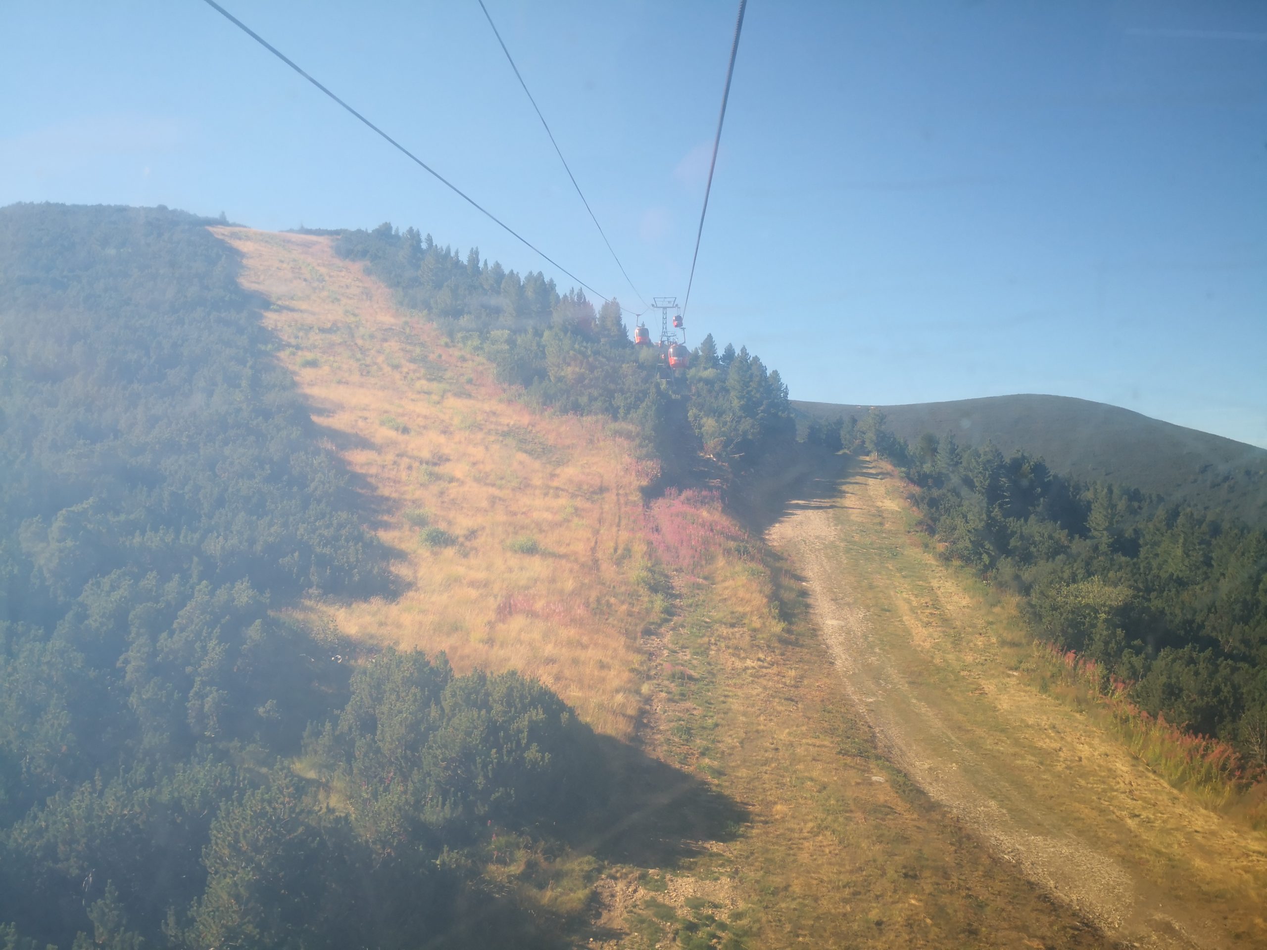
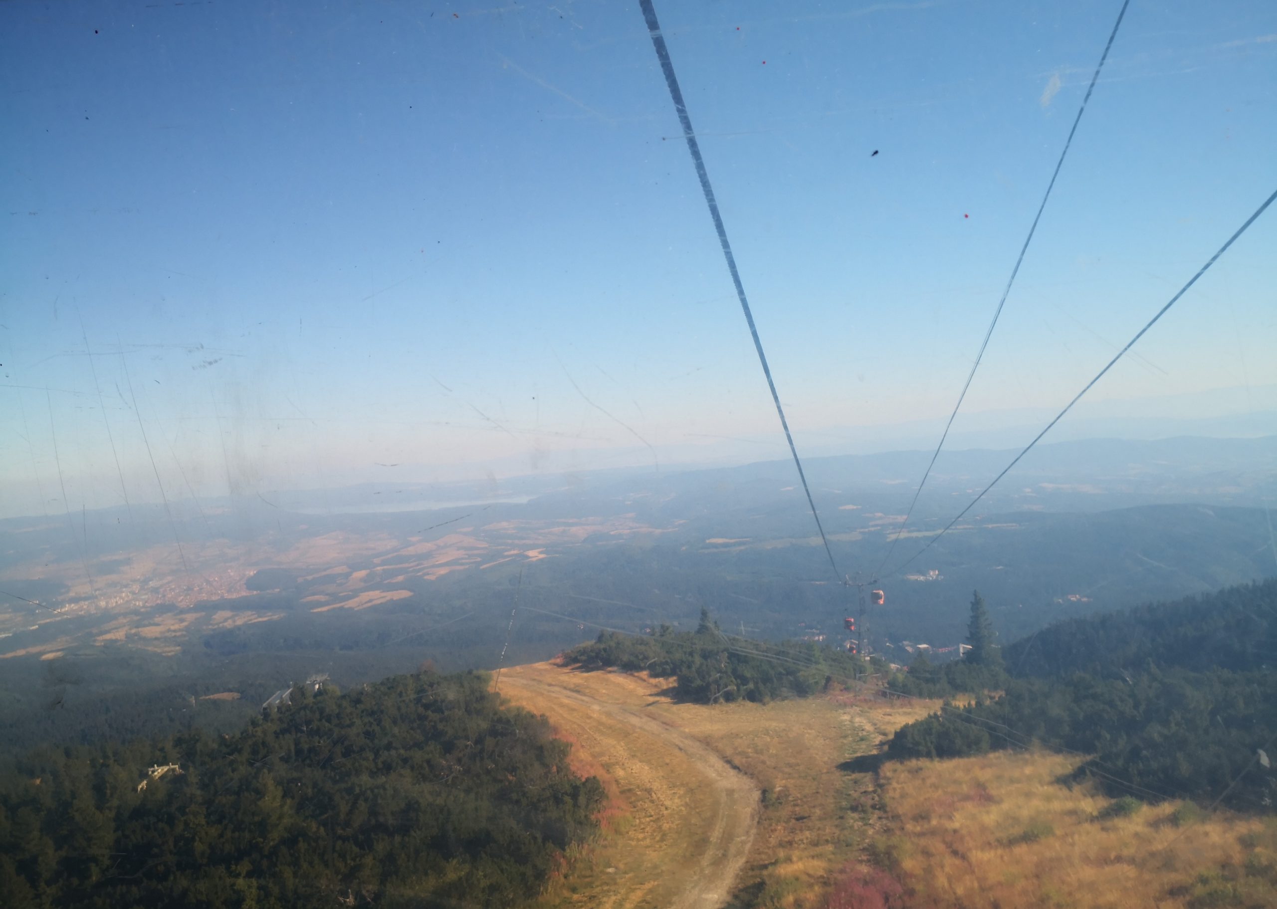
We read a blog on a solo hiker’s guide to Musala, which is very informative, but this blogger lady’s stamina is beyond us. She hiked all the way from the foothill to the top and then back in a total of eleven to twelve hours without much food or water, but we took the gondola lift to about mid-way of the mountain, and hiked up for about three and a half hours and hiked down for about three hours between the gondola station and the summit, it was already a very full day. Some segments of the gondola route are very steep – they look to be almost at 70 degrees, while the hiking trails must be more winding and longer than the gondola route. I would not want to hike up or down from the gondola station to the foothill.
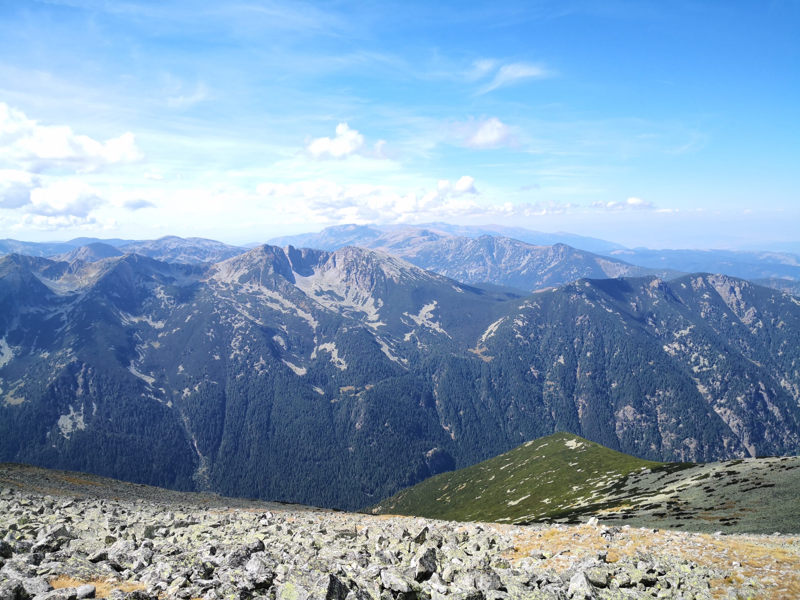
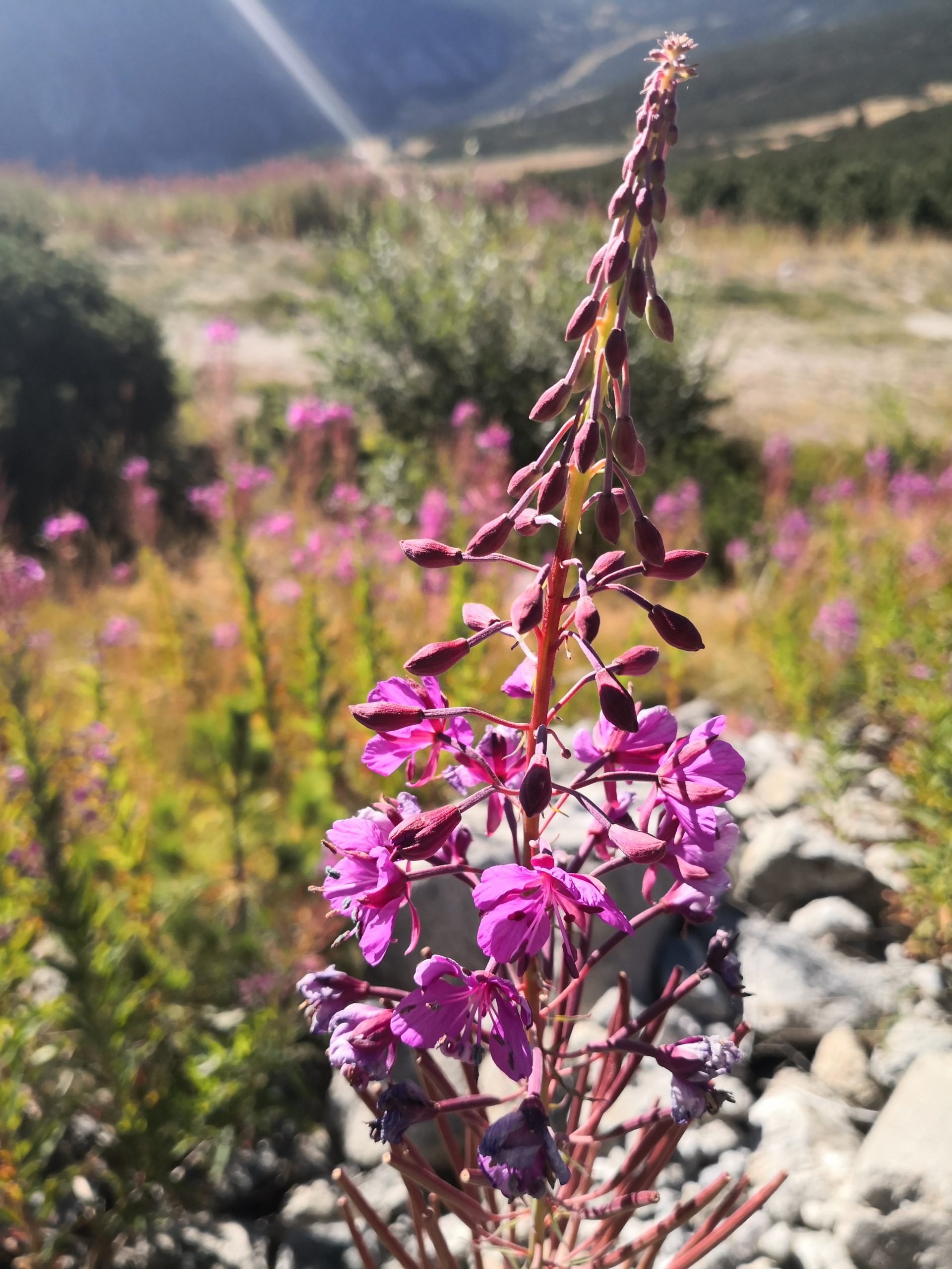
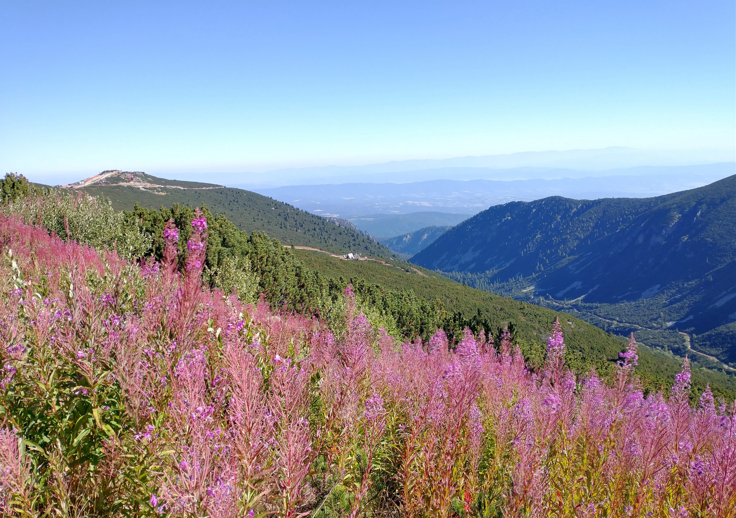
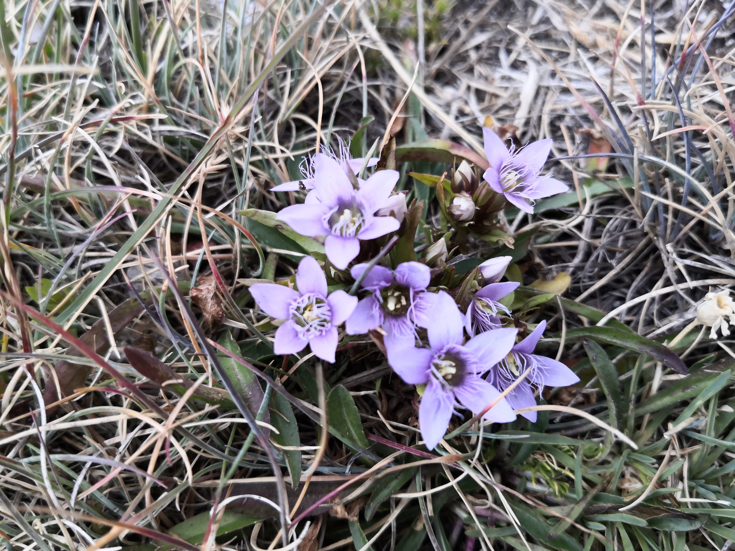
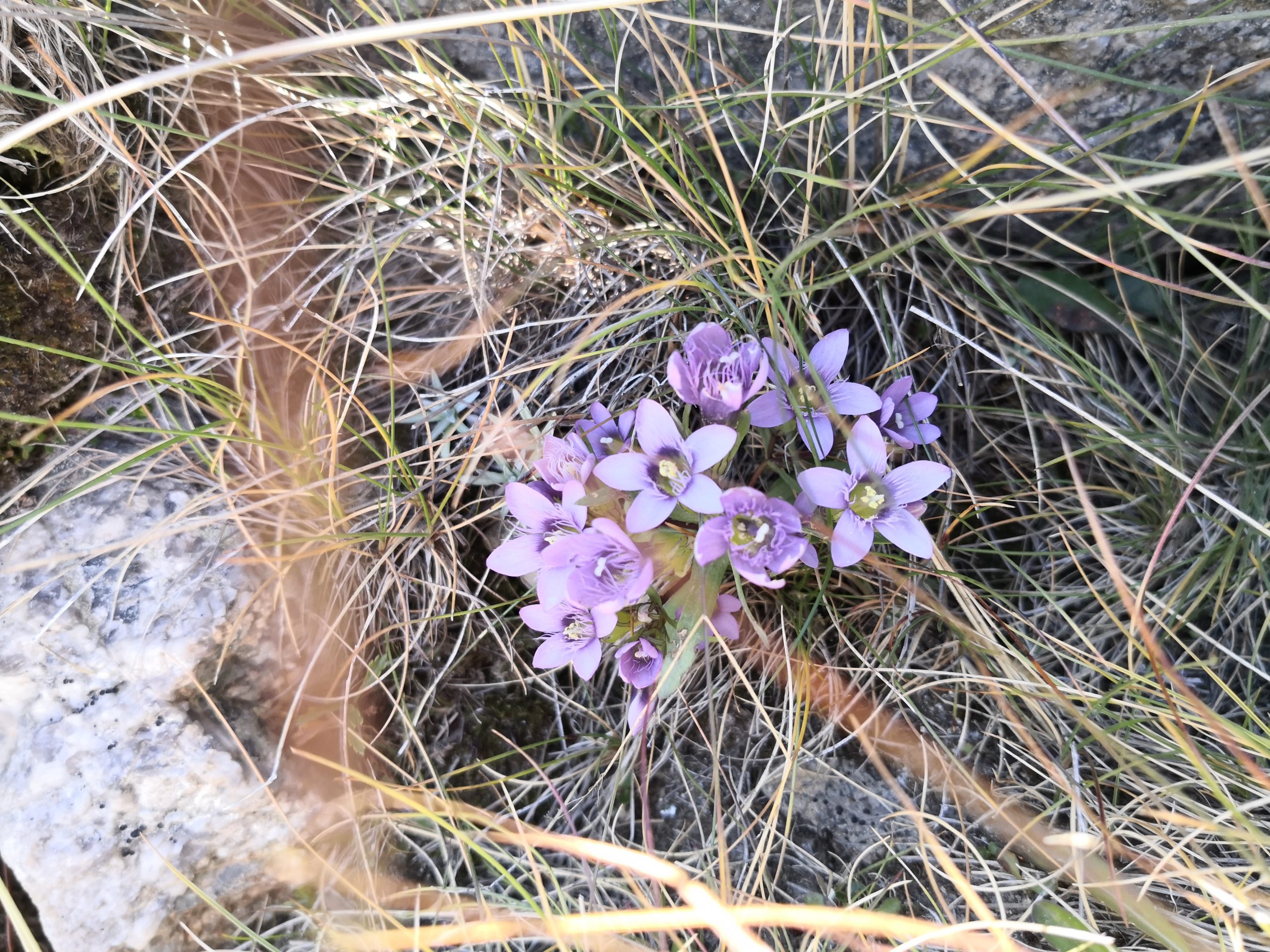
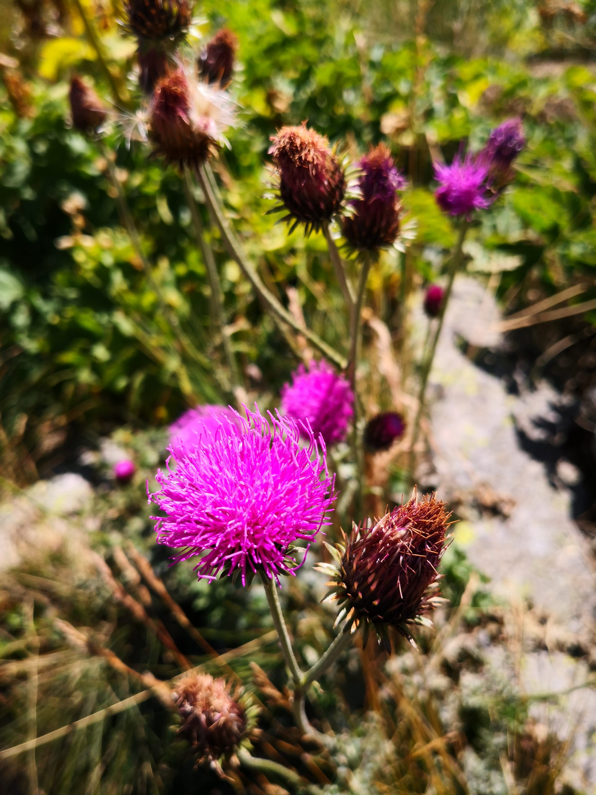
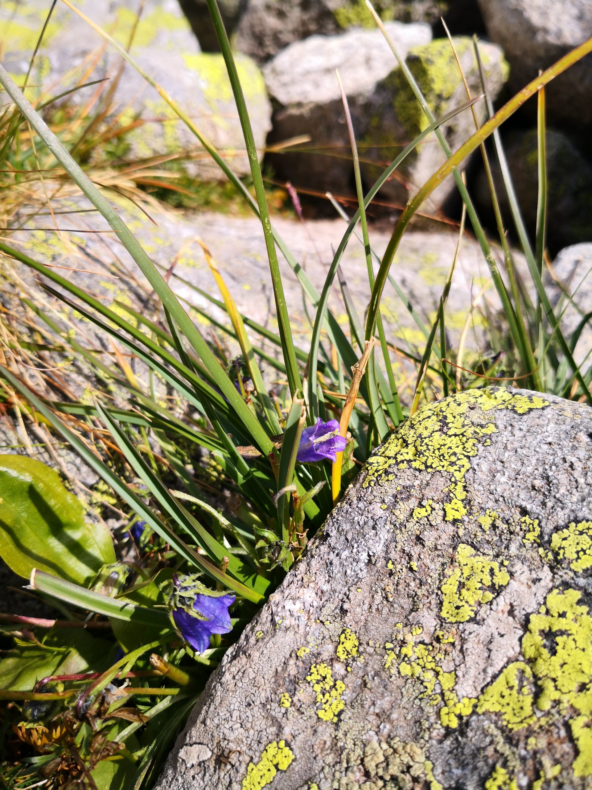
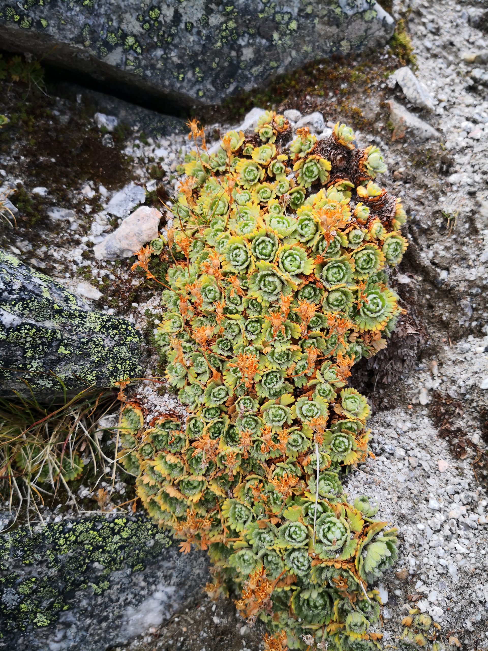
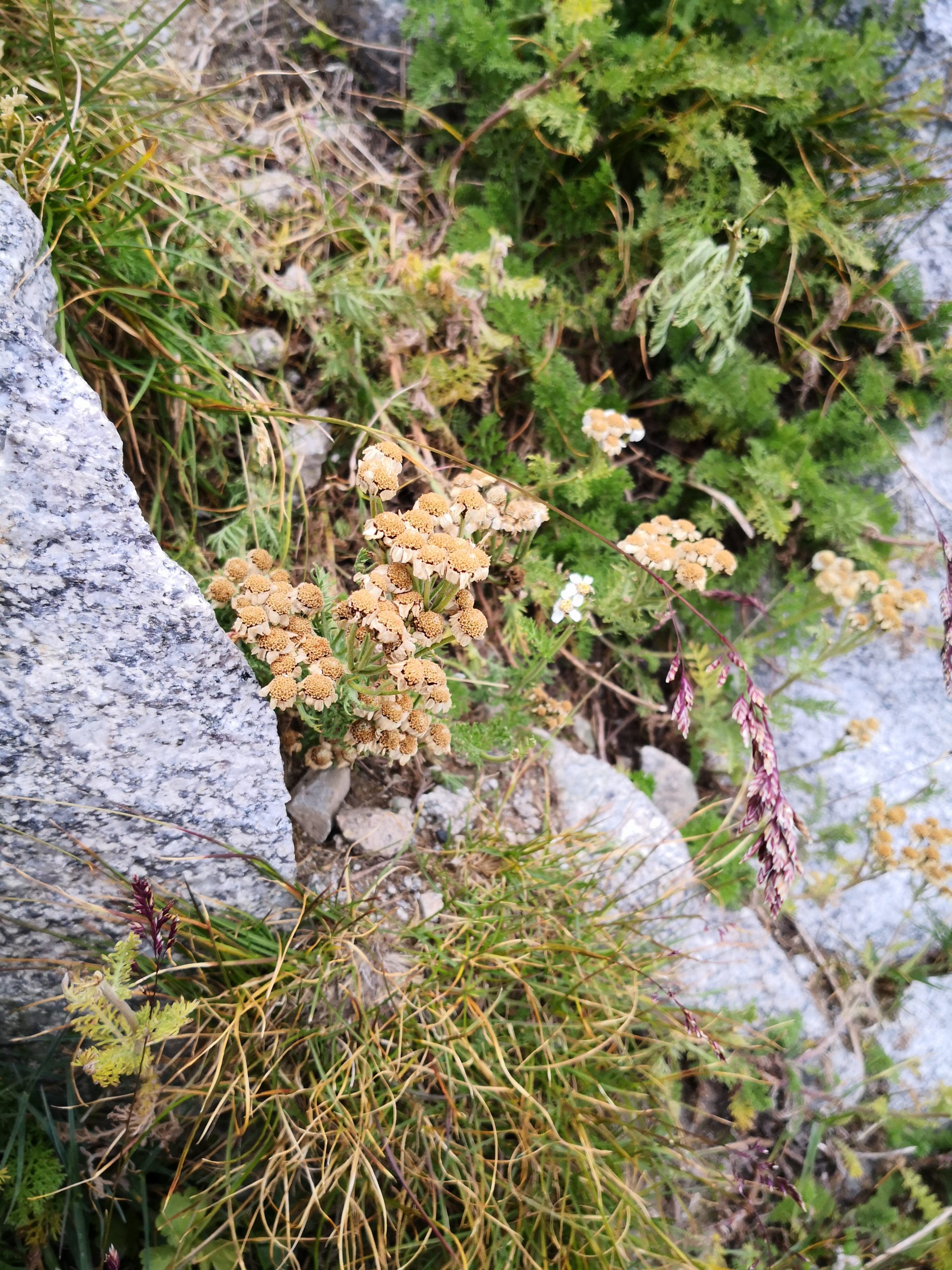
Given the high altitude of the mountain, the vegetation changes quite obviously from bottom to top: to be shorter and shorter. The purple mountain flower is right in the season to cover a wide area here or there, while other blossoms are tiny and crawl on the ground. Near the top of the mountain, there are only lichens and mosses, but even those have their own patterns, which are quite pretty. The last photo of pears was taken when we walked in the town of Samokov. We’ve seen almost all kinds of fruit trees on the roadside in Bulgaria, except pears, up to this point, and finally, we saw a pear tree.


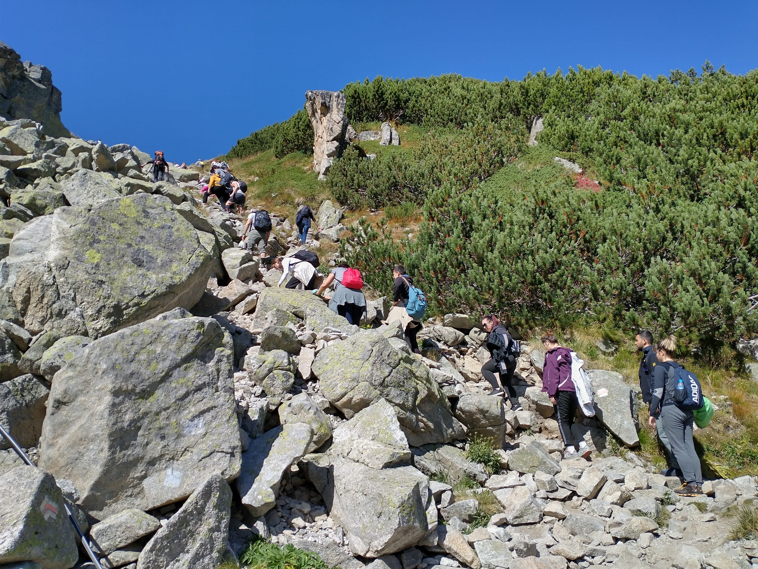
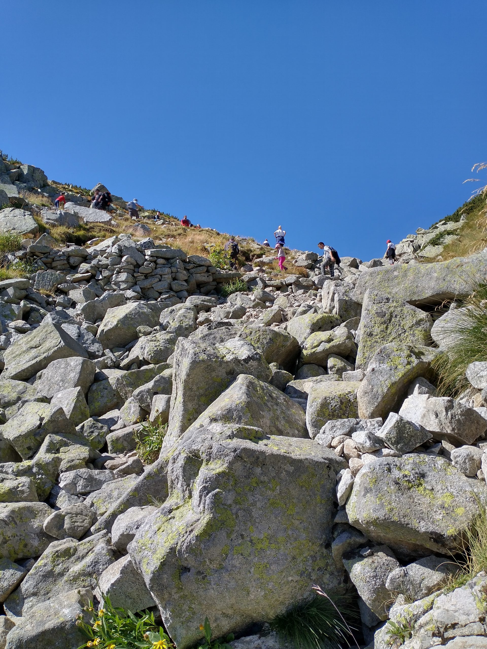
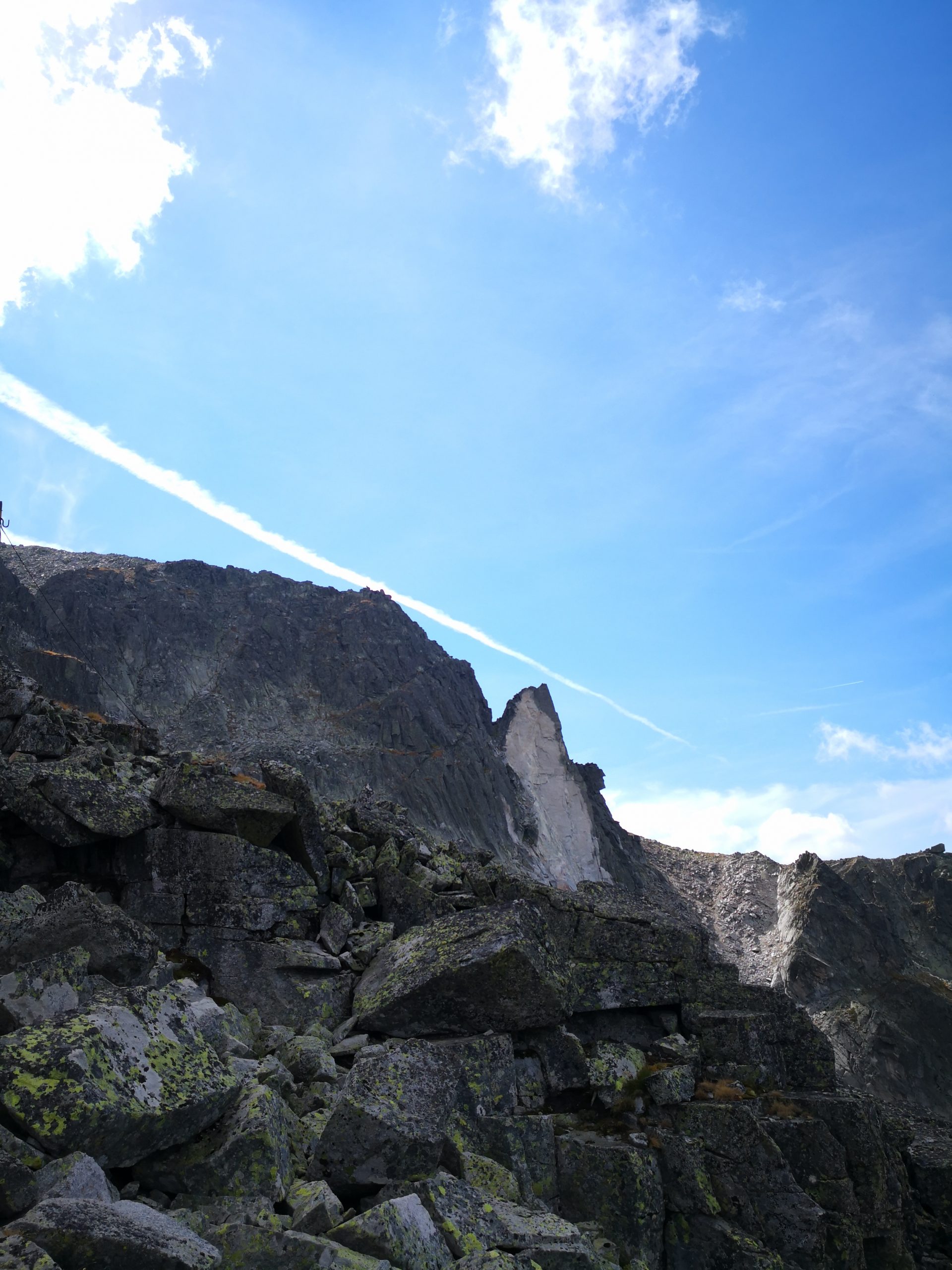
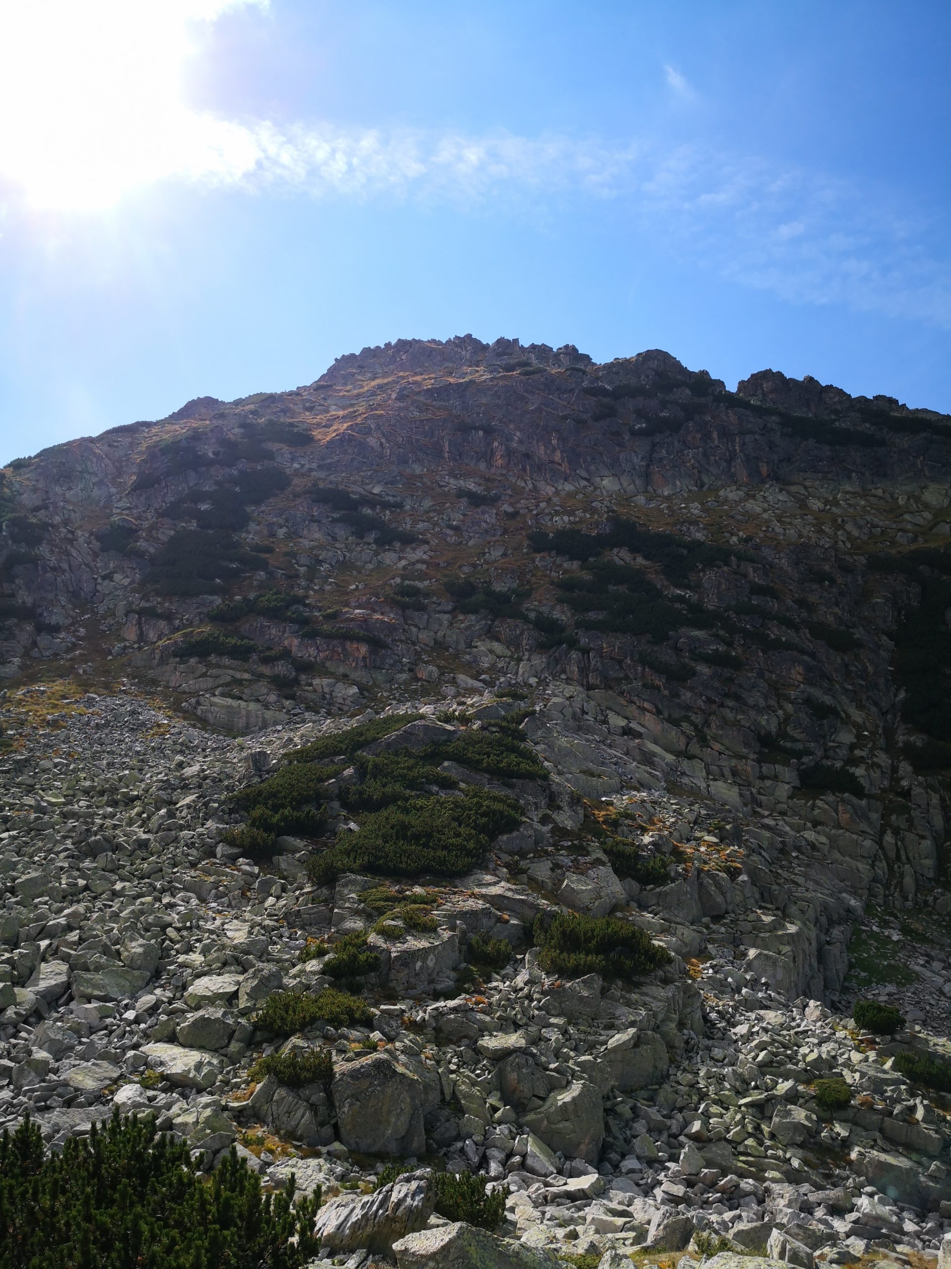
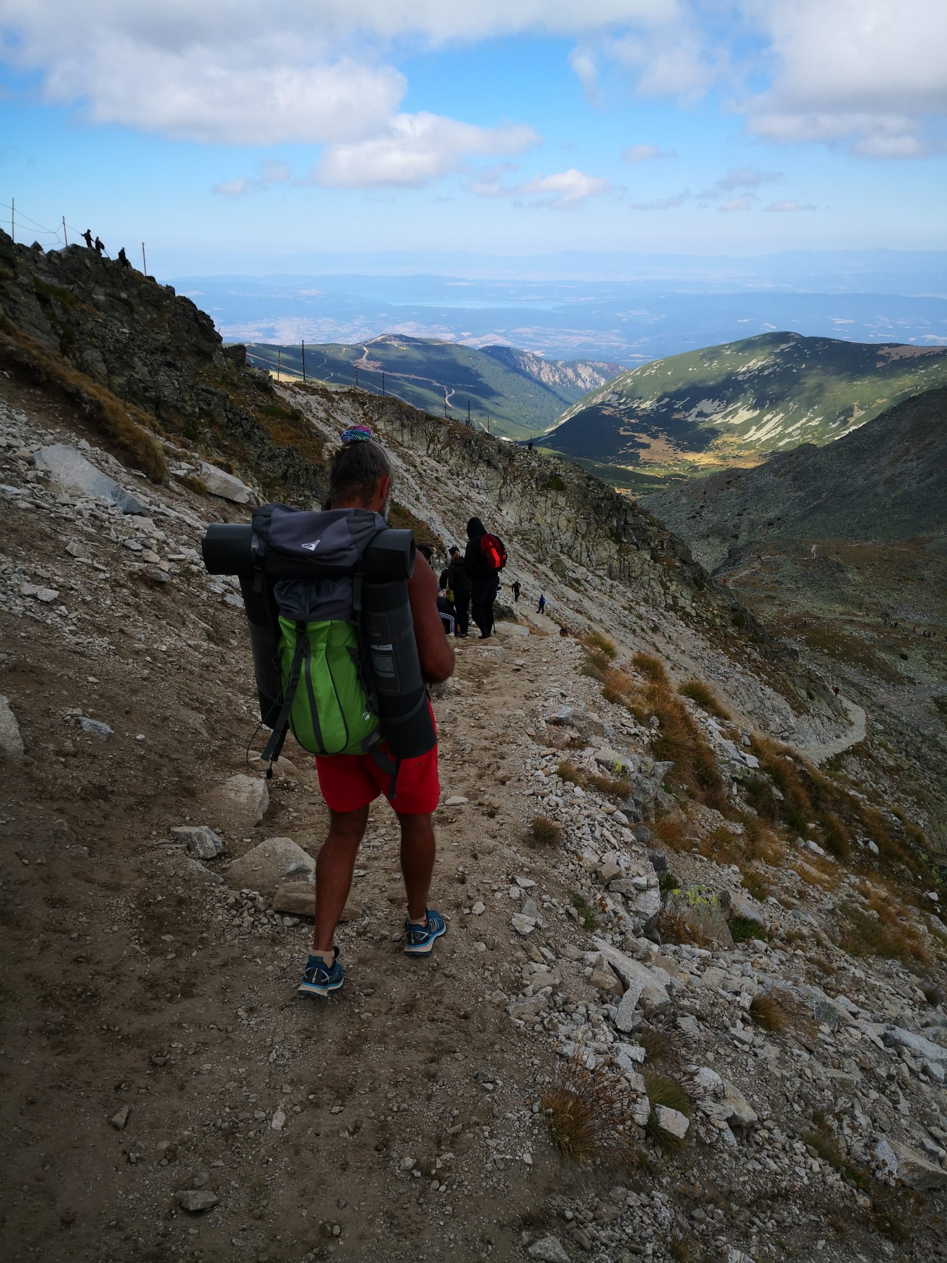
The hiking trail is mostly a rocky path, with a few sections to be a bunch of rocks piling up. It is like the Bearfence Mountain Trail (a rock scramble in the Shenandoah National Park in Virginia) on steroids, and we really liked it (although our legs complained).


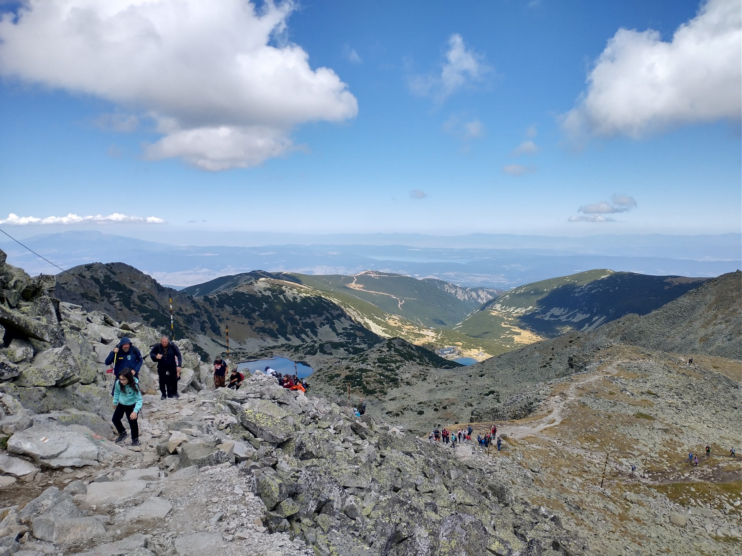

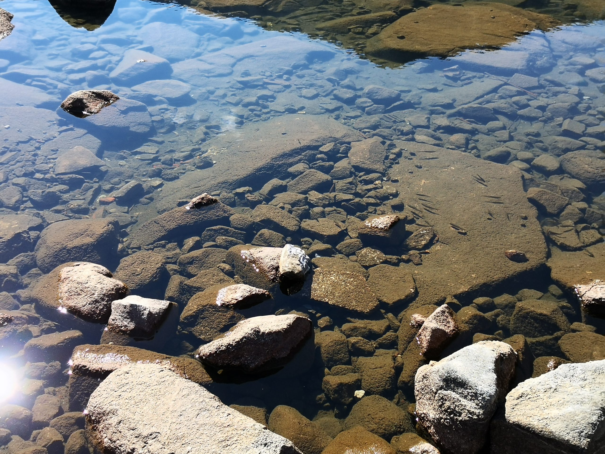
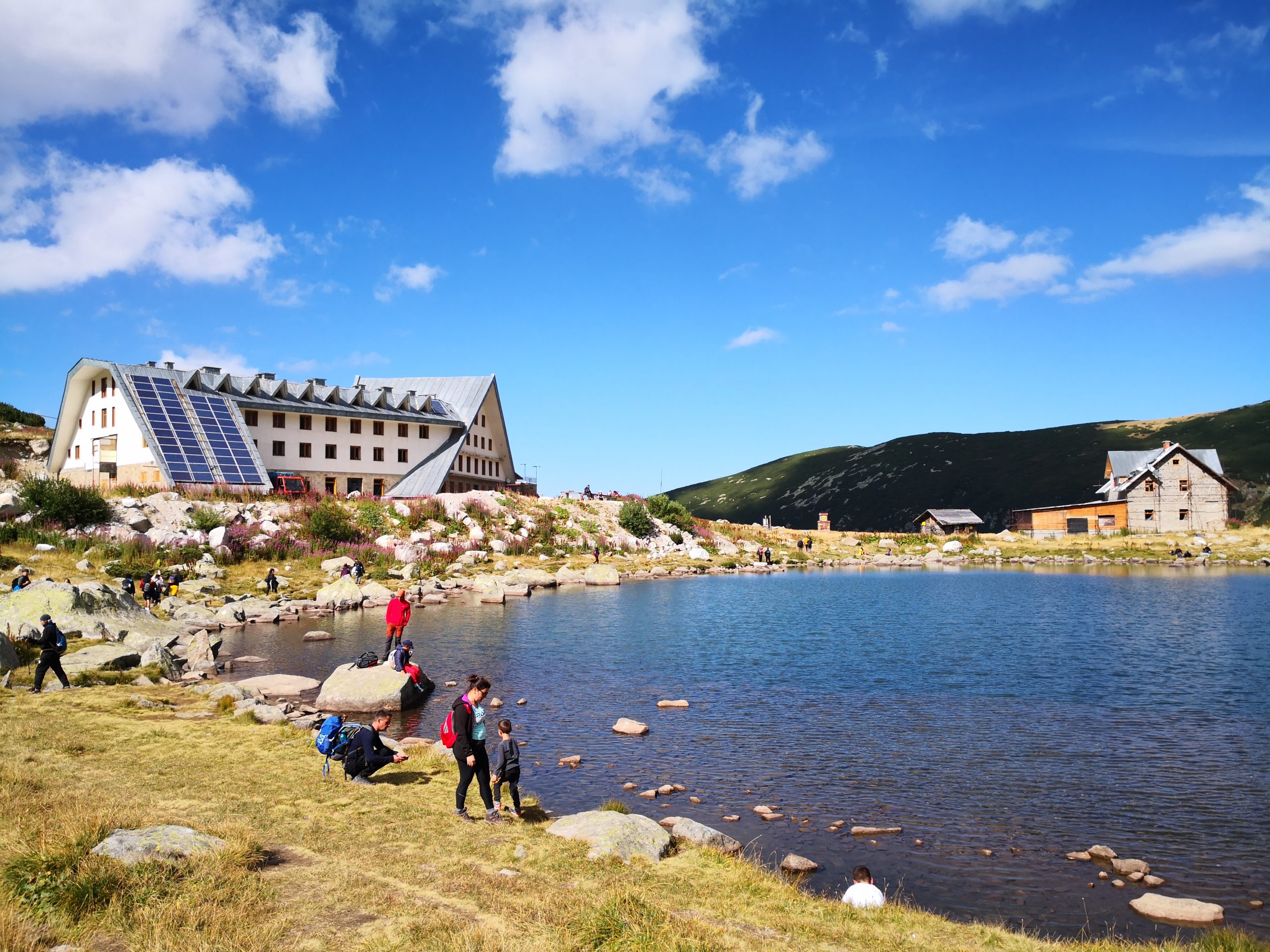
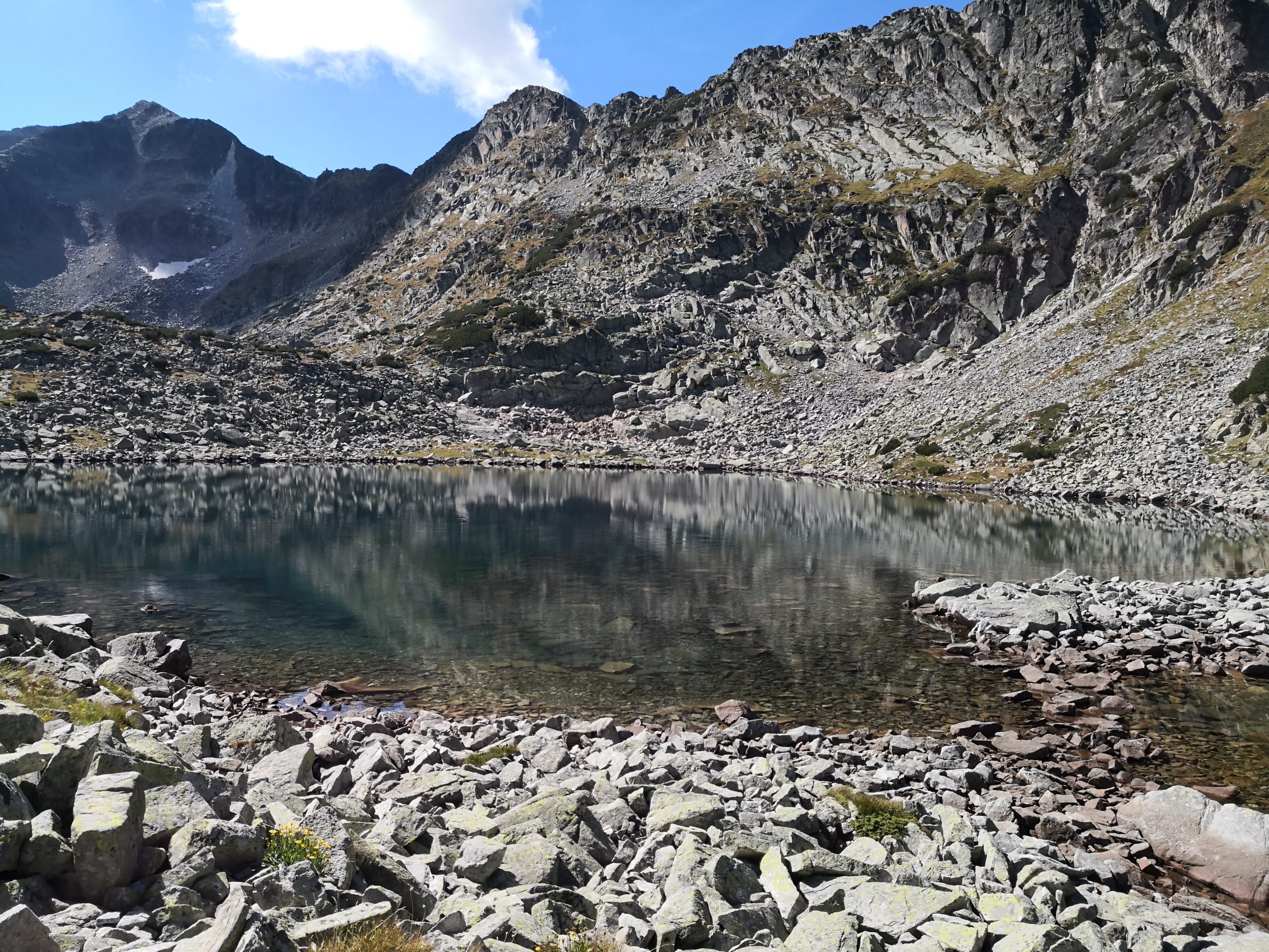
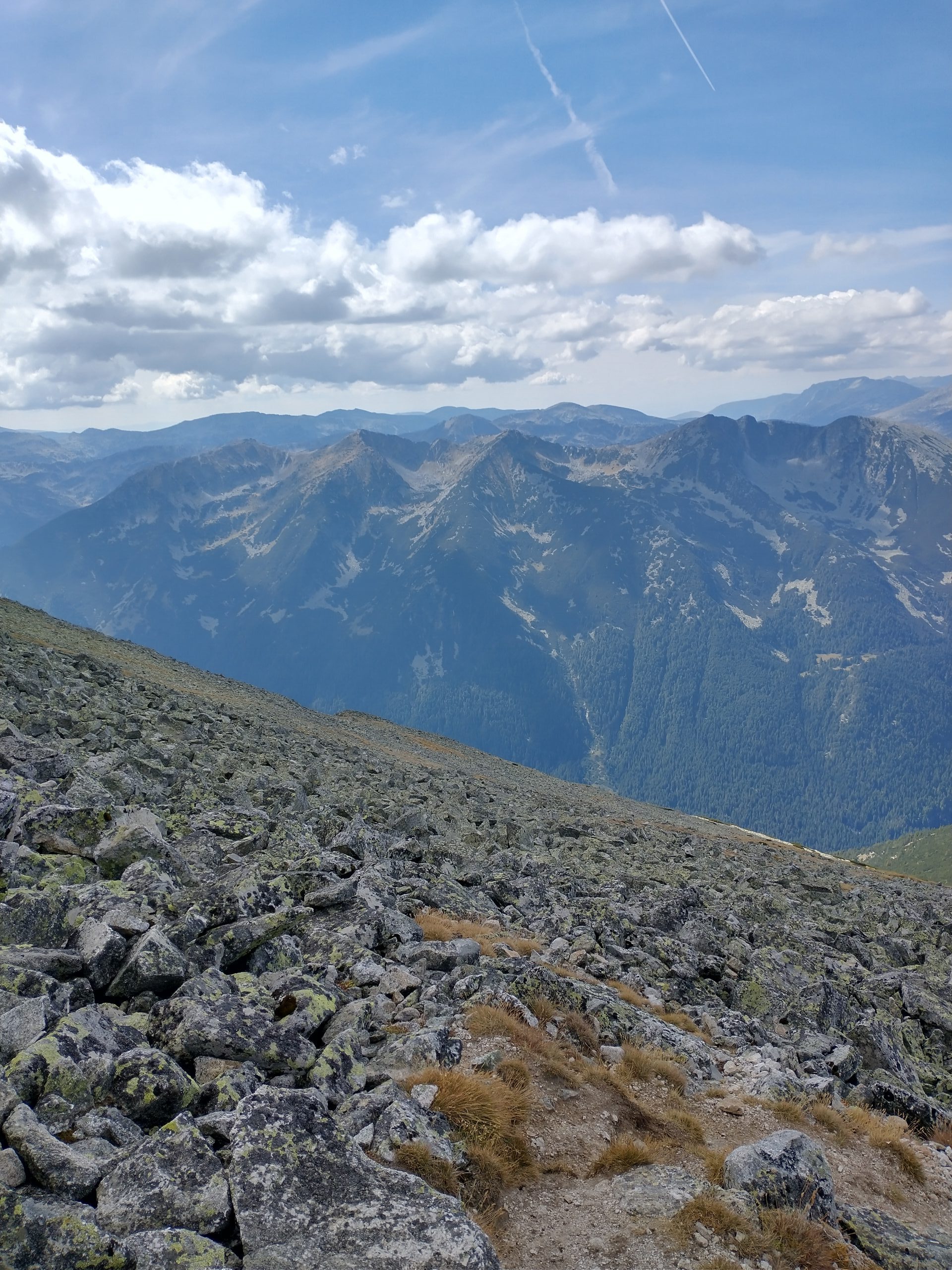
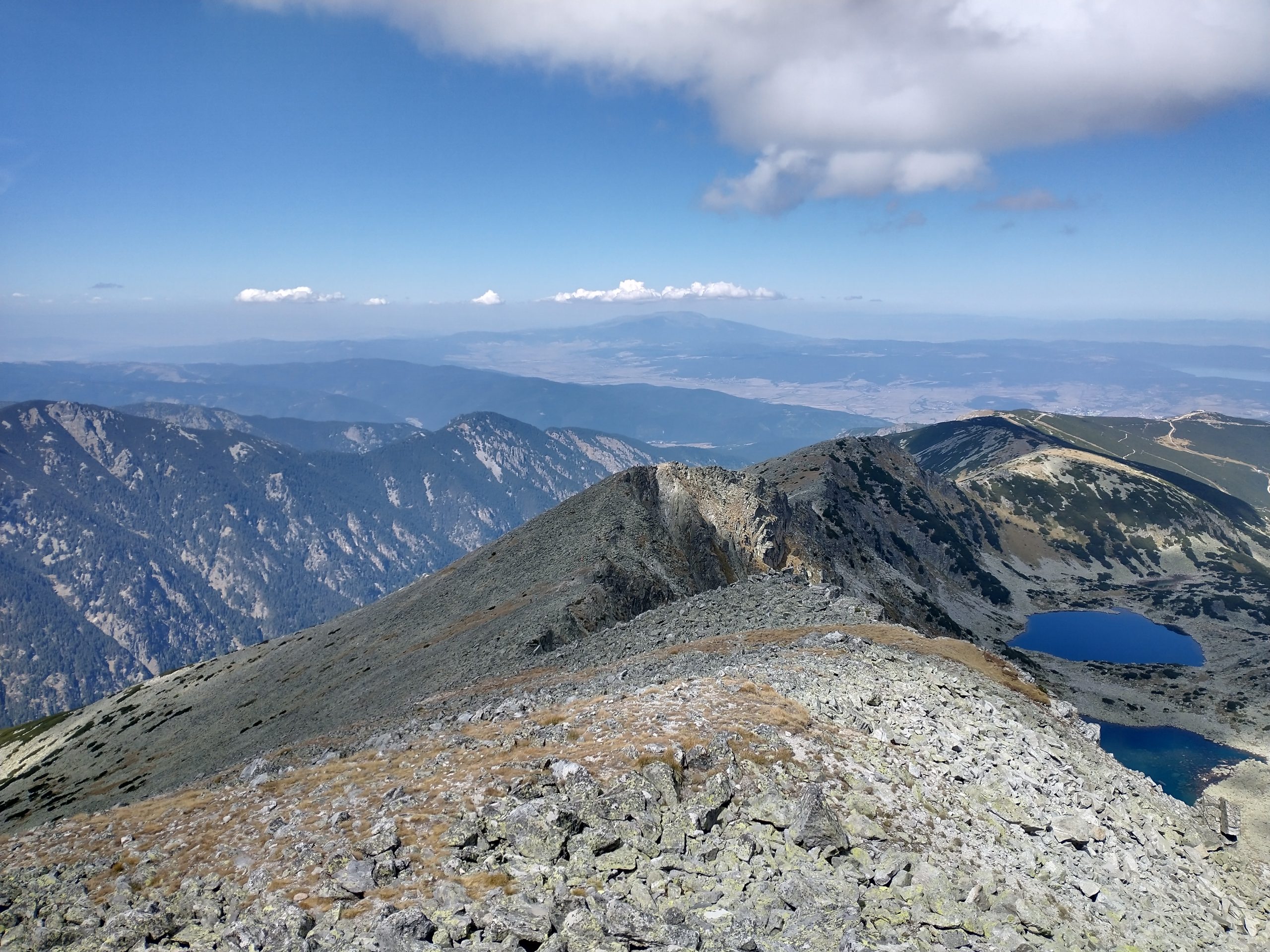
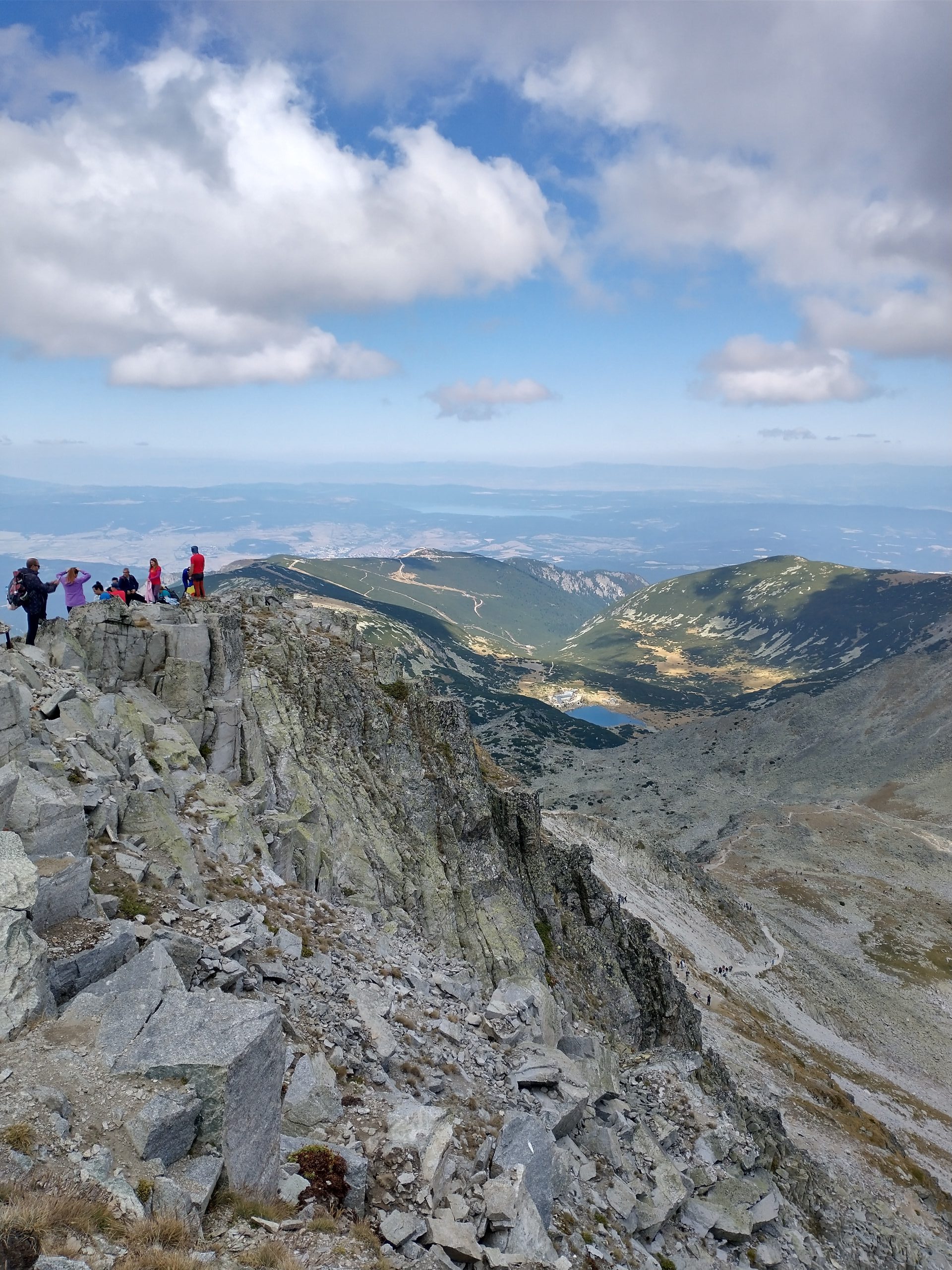
There are several beautiful lakes along the trail. The water color is deep and pure, and there are schools of small fish swimming in them. The last segment of the trail is along the ridge, and we could see the lakes on the other side of the ridge, which are also pristine.
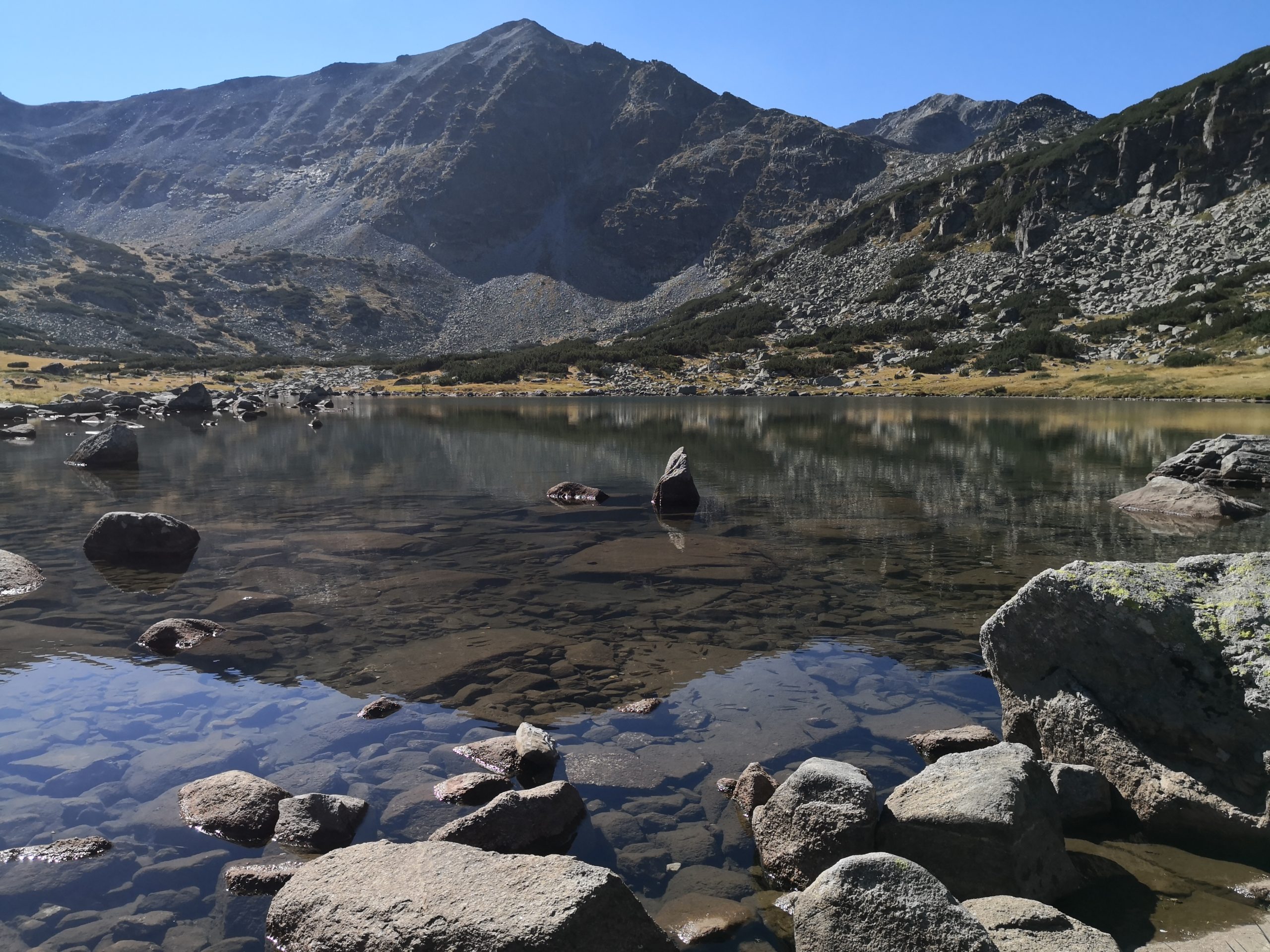
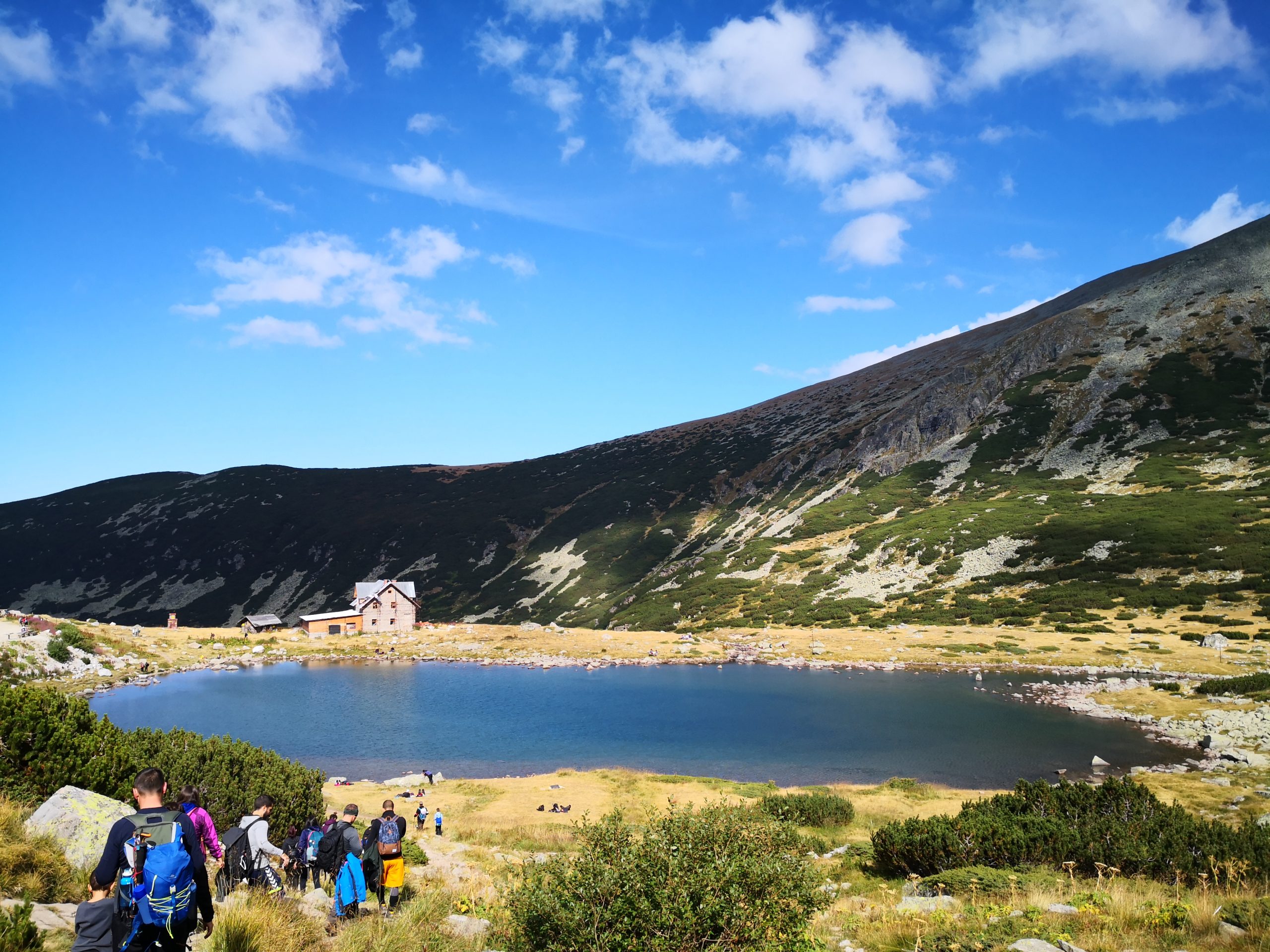


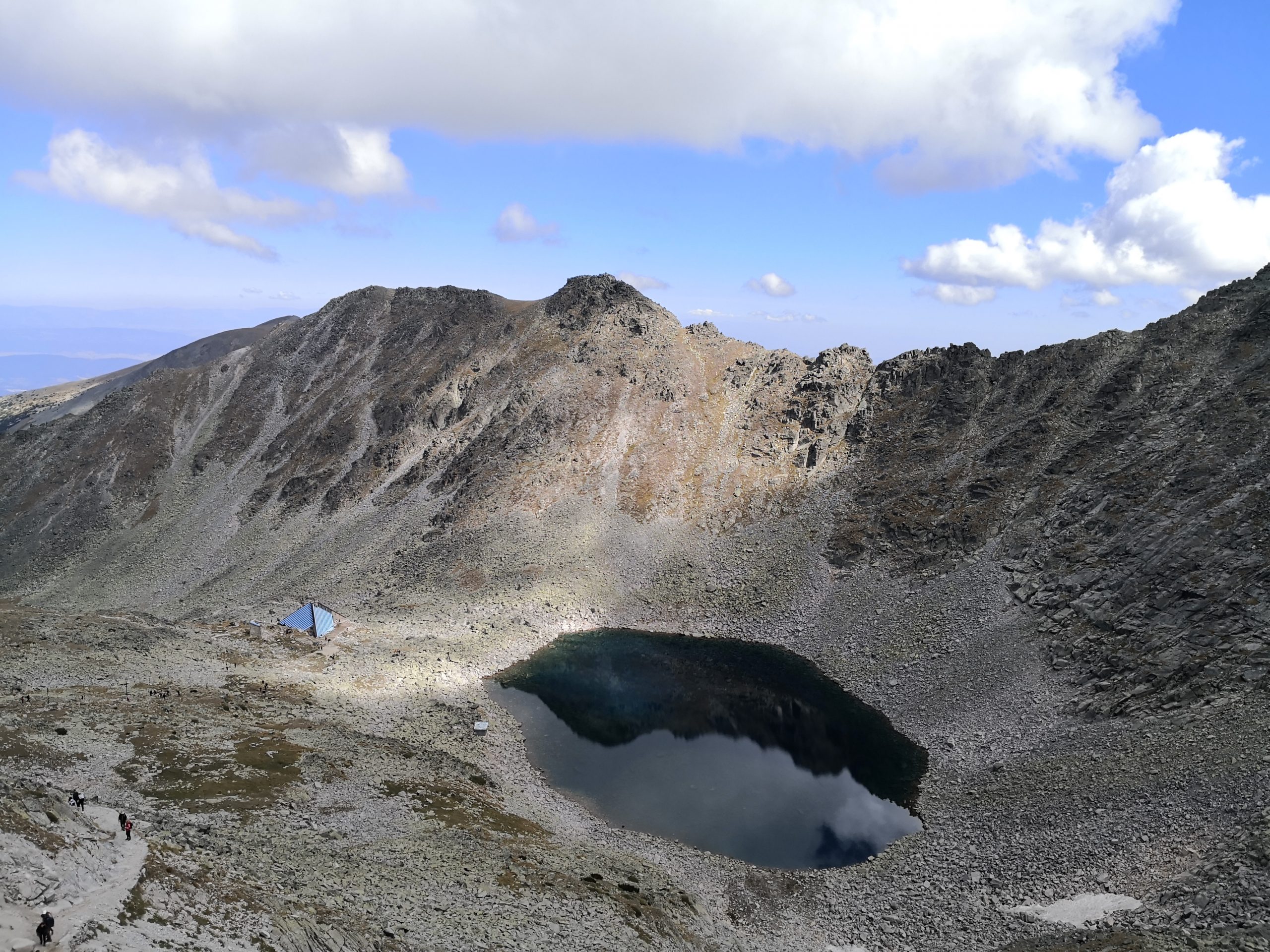


We enjoyed this trail as the view was expansive with some mountain peaks and lakes always in view, and yet the trail also progressed in segments. We might see a peak as the target for some time to reach a relatively flat area, and then we got to see the next peak, instead of seeing the highest peak at the beginning to feel overwhelmed. At the top of the mountain, the view was gorgeous all around as shown in the featured gallery at the top of this post and the one below.

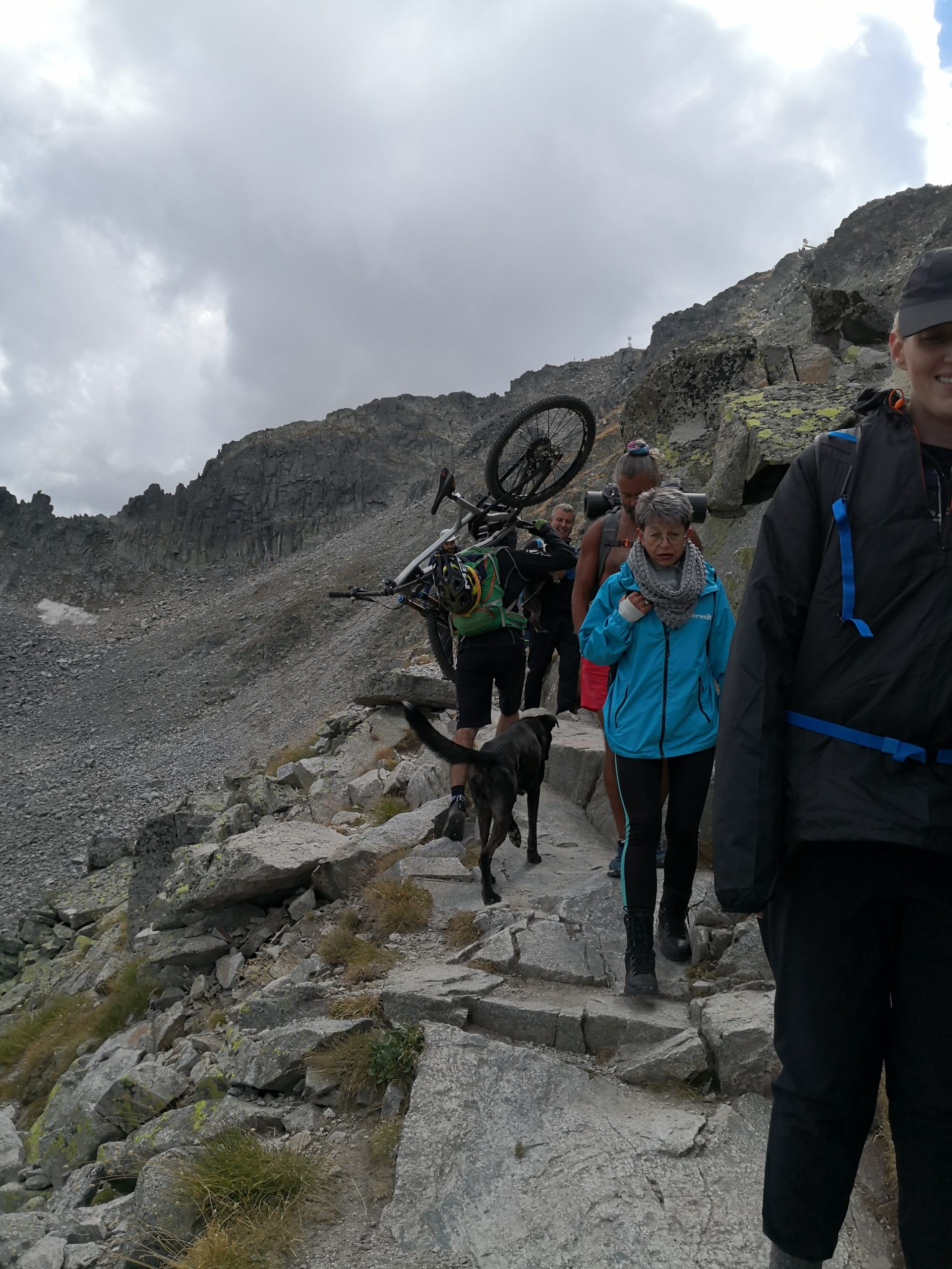
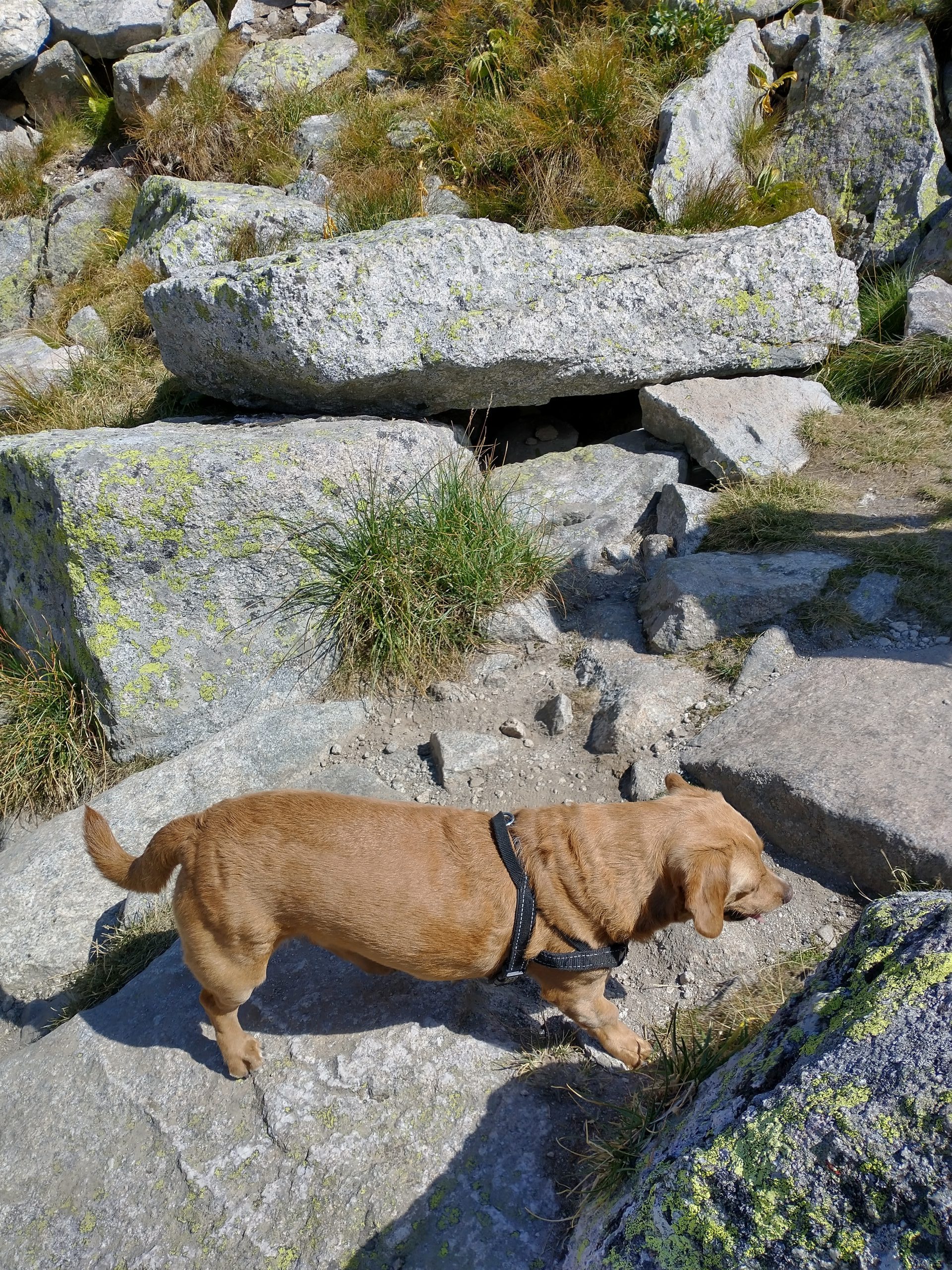
The trail could be labeled as strenuous due to its elevation and piles of rocks on the way according to some U.S. park standards, however, there doesn’t seem to be a hiking difficulty categorization here nor any restrictions on dogs. We saw families of three generations with toddlers, senior club kind of groups, and several dogs on the trail. Occasionally, the toddlers and some small dogs might need to be carried, but the lodgings on the trail could help some people to rejuvenate, and the trail is mostly accessible for all the people. The bigger dogs had collars and all, but they were not leashed so that they could run freely instead of being dragged down by their humans. They often ran ahead and then ran back to meet up with their humans and the dogs didn’t seem tired. All the dogs we met were very well behaved. We tried to catch up with some dogs but it was not easy. With a few rounds of passing by or being passed by the dogs, we remembered quite a few of them.
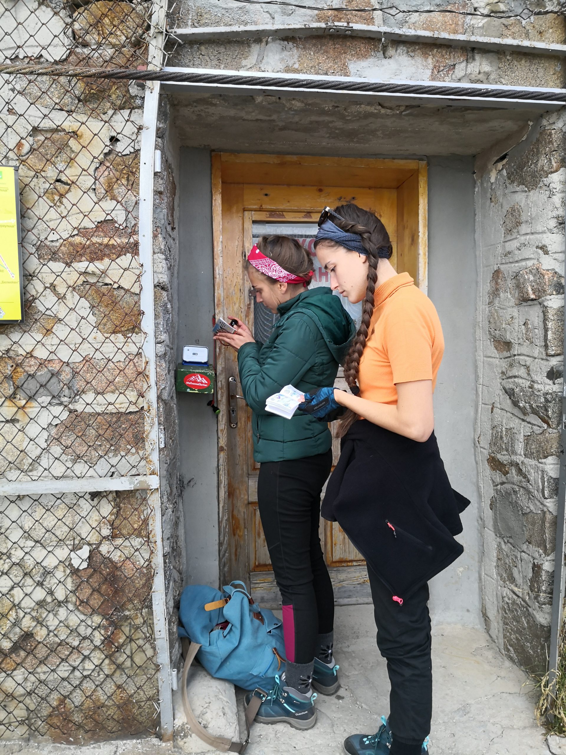
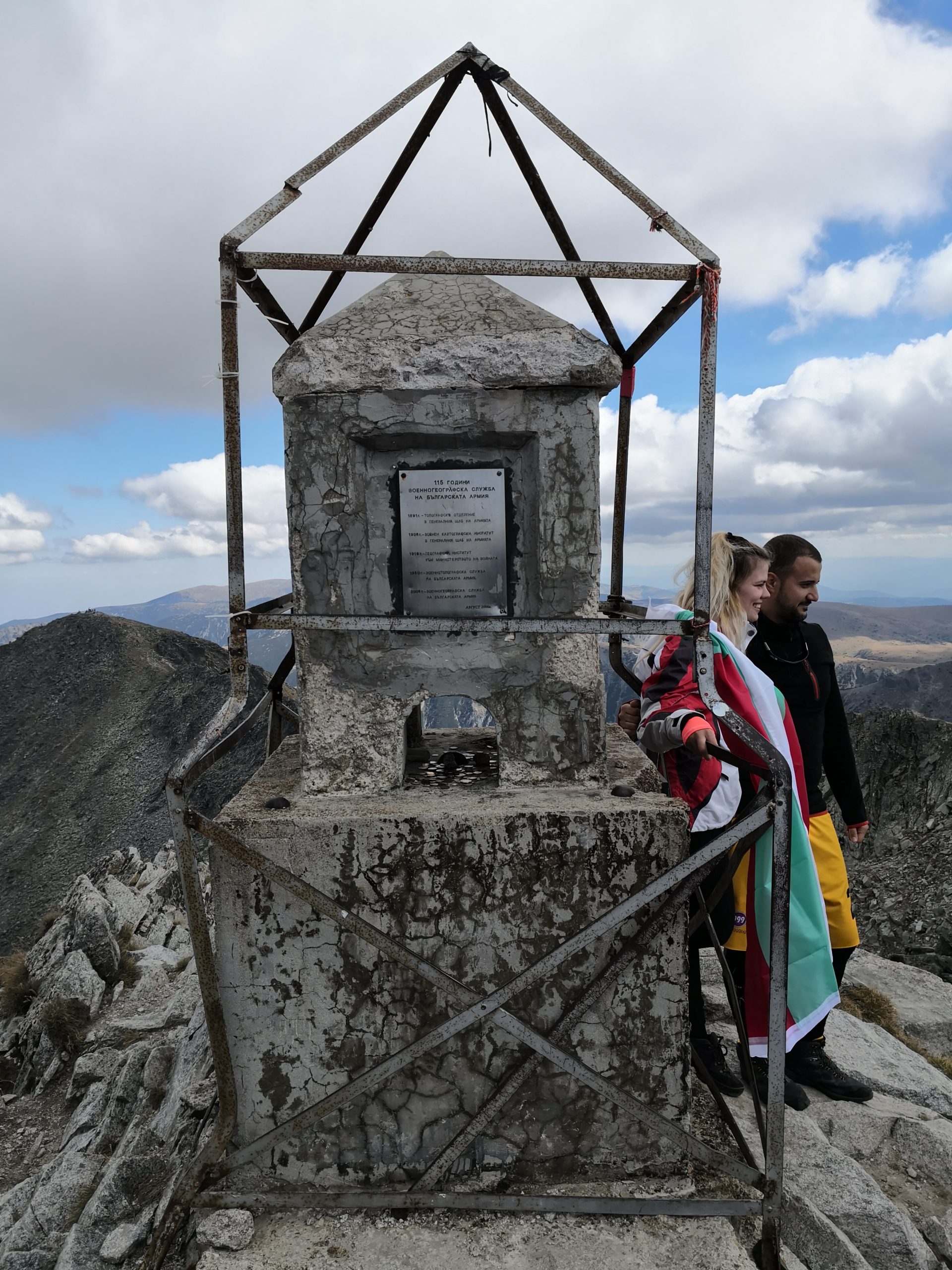
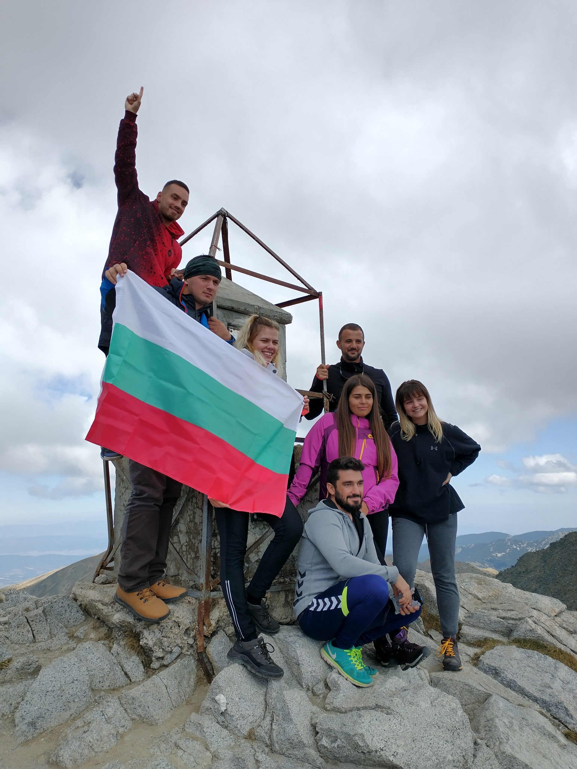
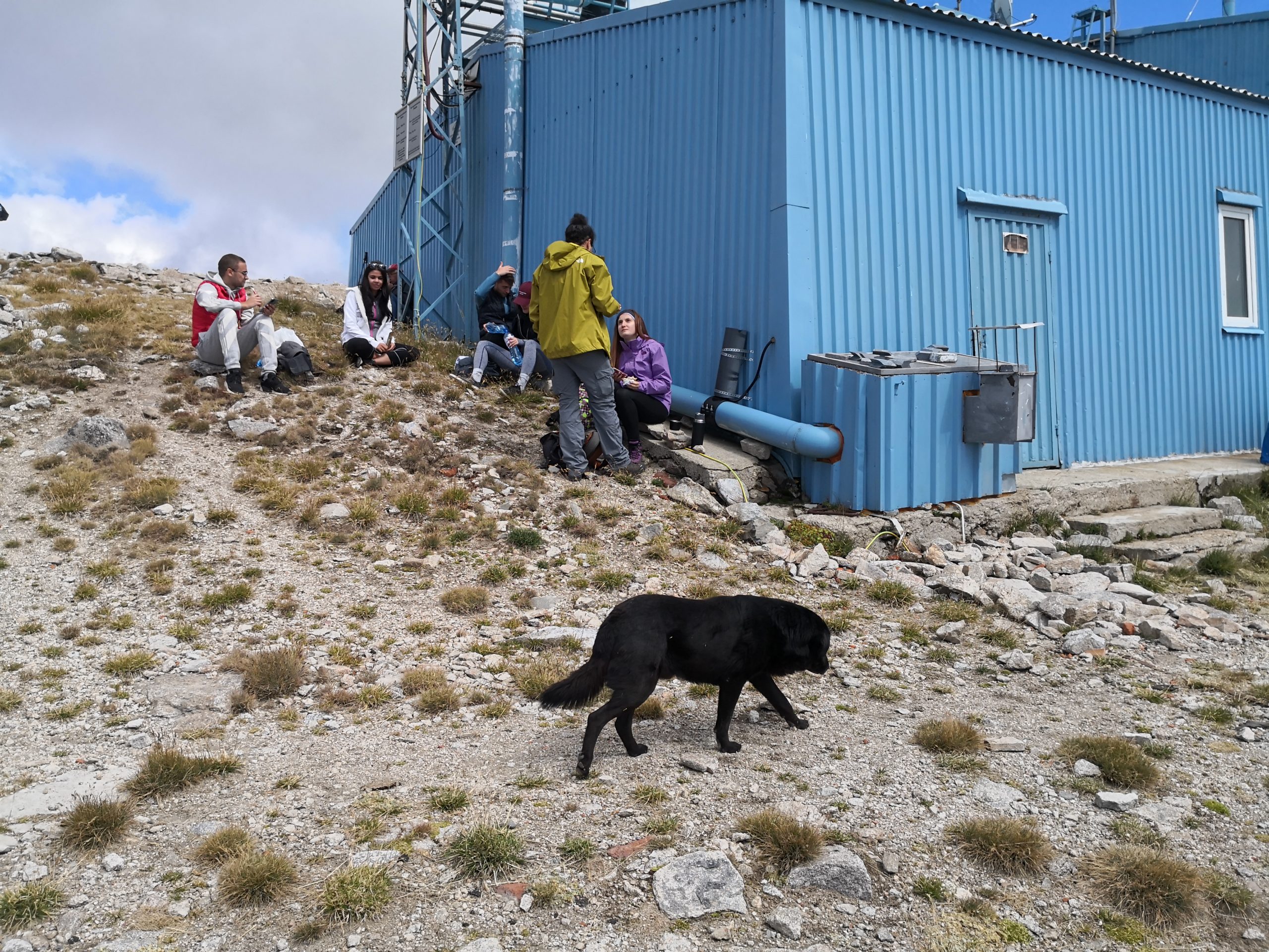
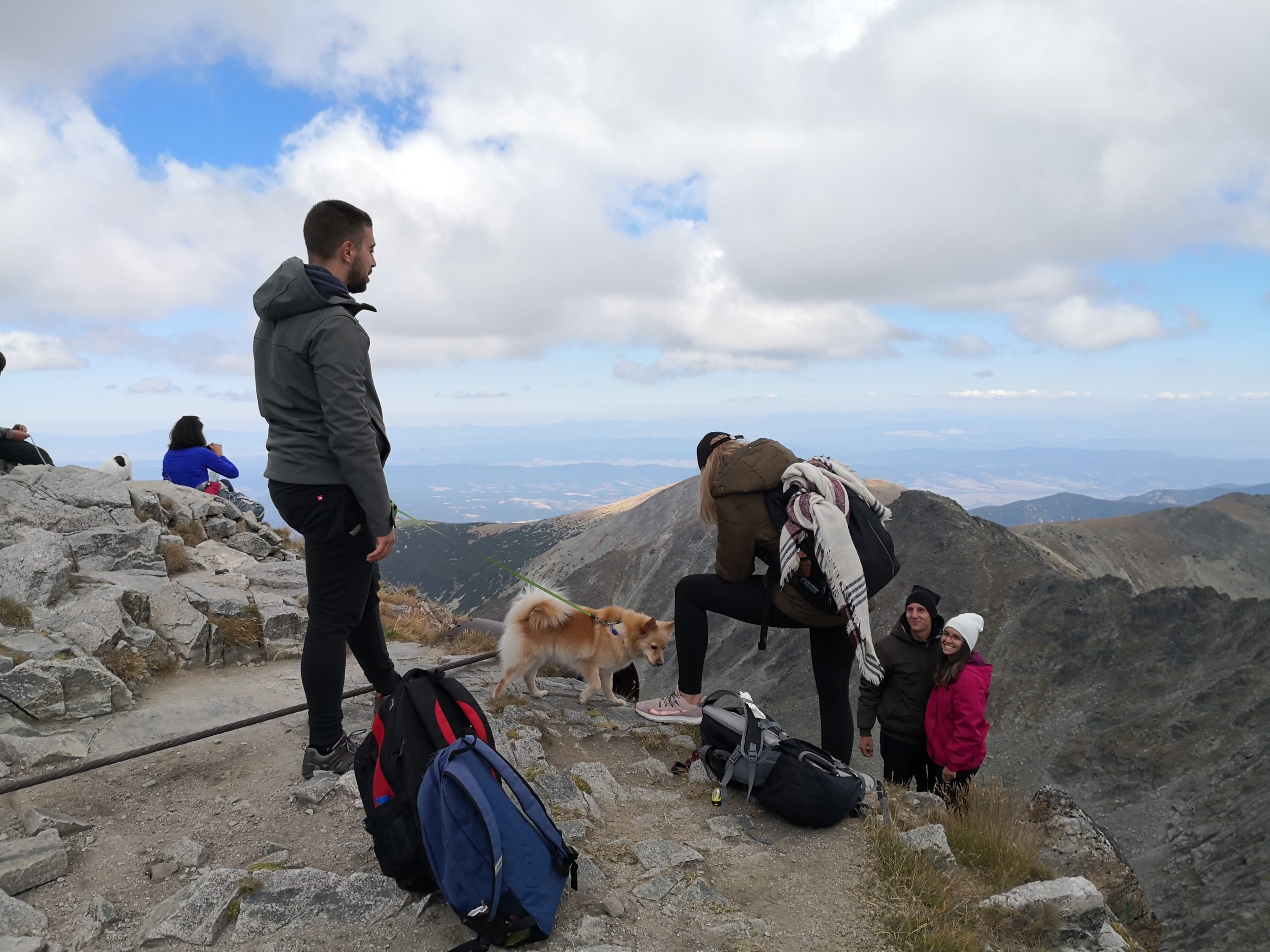
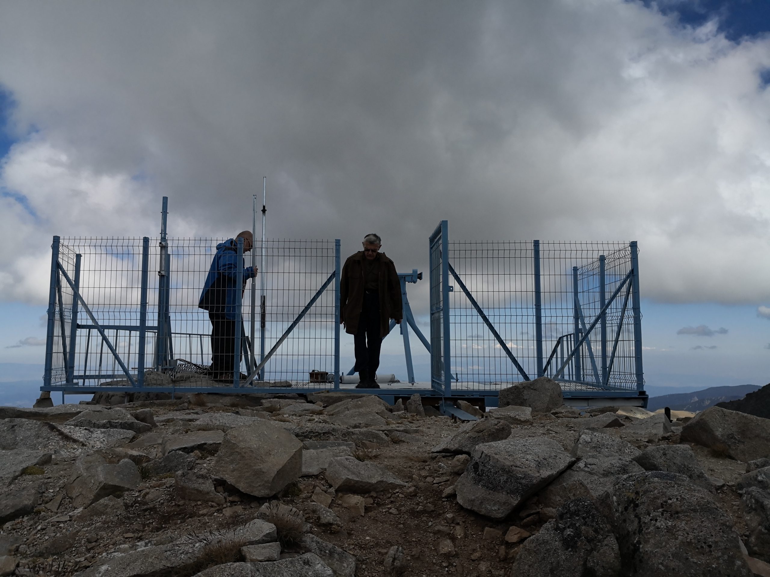
Based on what we heard other people were talking, most visitors were Bulgarian (since we didn’t understand them), but we chatted up with a few hikers from Iceland (the three guys in one photo below), Sweden, and UK, as well. Some people (the two ladies in one photo below) carried their travel booklets to collect stamps at various attractions (there is a self-service stamp station at Peak Musala). A hiker that looked like a backpacker bared his chest and wore only shorts, even at the summit, that could be a bit chilly if people sat there for a while. The most sporty man we saw carried a bike uphill. I thought that there might be a special bicycle trail from the mountain top to go downhill, and then I found this biker video, in which the biker used the same route as the hikers and the bikers would need good control of their bikes. At the summit, people waited in line to take a photo at the stone marker structure site, and quite a few of them threw on the Bulgarian national flag proudly while taking the photos. There is also an environmental observatory in the institute for nuclear research and nuclear energy for Bulgarian academy of sciences at the mountain top, and we saw the researchers measuring something at that station (Edit on 9/24: I heard that these scientists were measuring the radiation levels as nuclear power plants provided about 40% of the energy consumption in Bulgaria, and this station could also help monitor if there is any accident from nearby countries).


The Musala trail was quite memorable and we were distinctly aware that we were not in the U.S., but on the bus between Sofia and Samokov, we were on the winding roads with many trees on the hills by the roadside, and we passed by several long lakes (one of them is even controlled by a dam to generate electricity), that made us feel as if we were on Highway 107 to Highlands passing by Lake Glenville. We hope that everyone is safe and well, no matter where they are.
Just as a record for whoever may need the info, below is the detailed direction to get to the trail from Sofia and be back.
1. First, take the bus from Sofia (СОФИЯ) to Samokov (САМОКОВ). The bus starts at the Sofia south bus station (not the central bus station, Serdika bus station, or west bus station) from 7 am and continues every 30 minutes. The second table on this site is the time table for the buses going from Sofia to Samokov. Although the site is in Bulgarian, one can translate it, as there is no English site from this company. This south bus station is close to the metro line M1/M4’s Joliot-Curie Metro Station. After one gets out of the metro station, s/he should walk along the side ramp road (not the main road) towards south for a few minutes until s/he sees the yellow building tucked under the road bridge (use this Google map address in the name of “Sofia Yug (South) Bus Station” with hundreds of reviews (and don’t be deterred by the reviews) instead of the location in the name of “Sofia south Bus station” with only one review so far, as the second address was not correct). The ramp roads are one-way for cars, so if the taxi driver exits the main road at about the place of the Joliot-Curie Metro Station, the driver will use the ramp road on the east side, and that’s okay. In the name plate of the building, ЮГ (pronounced as Yug) means south. The bus lines are in front of the yellow building. The buses that go between Sofia and Samokov often run in round-trips with a sign of “СОФИЯ САМОКОВ СОФИЯ”. Get on the bus and buy the tickets from the driver. This bus station is small, but many buses to the attractions in the southern part of Bulgaria start here. It is a great service that they provide. A taxi driver would know the location of the south bus station and using a taxi can be a great time-saver.
2. Once reaching the Samokov bus station after about an hour and 5 minutes from Sofia, the best next step is to take a taxi waiting near the exit of the Samokov bus station to get to Borovets (Боровец). Although there might be bus continuing from here to Borovets, it must be time-consuming, and the taxi drivers know that you are probably going to Borovets gondola lift station. It is a drive of about 10 km for around 15 Lev. The lifts are used for skiing in winter and hiking in summer, that’s a great way to fully utilize these facilities. There are other skiing resorts in Borovets, but this gondola lift (Lift Yastrebets, Лифт Ястребец) is the de-facto lift (not open on Mon and Tue, though) for one to get to the highest possible point for hiking to Peak Musala and most other lifts seem not running in summer. If you don’t need a bathroom break urgently at the Samokov bus station, use the WC at the next lift station, since people need to wait in line there for quite a while, and you may want to start your hike as early as you can. WC in Bulgaria often costs 0.50 Lev, up to 2 Lev.
3. The Borovets Gondola bottom station (Lift Yastrebets, Лифт Ястребец) is across the road facing Samokov Hotel (despite its name, it is in the town of Borovets). In the morning, there are two long lines of people at the lift station: the one near the building at the bottom is to wait to buy tickets, and the one at the upper parking lot is to wait to get on the gondolas. If you come in a group, send someone to buy the tickets while the rest can be in the line of getting on the gondolas. By default, they sell the round-trip gondola tickets for 20 Lev per adult, and you will be grateful for the round-trip ticket later. If one really plans on getting down the mountain by using some other trails without using the gondola, s/he could ask for a one-way ticket.
4. Once getting on the gondola, there are two points to get off (the mid-station at 1830 m altitude and the top-station at 2363 m altitude). Of course we want to continue onto the top-station without getting off at the mid-station. The gondola ride is for about 25 minutes with a length of 4827 m and a vertical rise of 1054 m.
5. From the gondola’s top-station, the signs of the trail are clear (arrows in white/green/red color, like a Bulgarian flag, or a square marking of white/red/white stripes), or one can simply follow the crowd. Along the trail to the summit, there are three areas with man-made structures (some of them should be lodgings) and some people should be able to stay there overnight (we didn’t look into such options, though). Near the topmost man-made structure, there is a pipe with water constantly running out like a fountain. The water is freezing cold but people can drink it and/or refill their water bottles.
6. After reaching the summit, we take exactly the same way back in the opposite direction. The last bus departing from the Samokov bus station to Sofia might be at 7 pm. The second table on this site is the fare and time table. Given the different carriers, the but fares can be different at different times. These buses are supposed to depart at whole hours and half-hour marks (such as 6 pm, 6:30 pm, and 7 pm), but most buses depart a few minutes early, as the drivers are mostly just waiting at the parking lot after they get there from Sofia and they would move to sector 7 (the boarding place for Sofia) about 10 min before the departure time to allow people to get on the bus. If no one else shows up after a few minutes, they just leave. We came back 5 minutes before the supposed departure time and saw the bus leaving the exit (sector 7 and the exit are at opposite corners), and we had to wait for the next one. The bus station building (on the sector 7 side) is next to a flight of stairs going up with water fountain in the center, which leads to the pedestrian street in Samokov, so you could walk around a bit if you need to wait for the bus. The bus we took also departed two minutes early. It is a good idea to be back at least 10 min before the expected bus departure time. On these buses, we often see locals get on and get off at some intermediate stops with a simple post sign or even without a sign, paying a fraction of the whole fare for that segment. For us, we would never know the names of these intermediate stops, and we probably never need to use them, but how I wish that I could speak Bulgarian to use the buses and many other services freely one day.
That’s beautiful! We do miss seeing your son in the band.
Dear Tiffany, thank you so much for taking care of us all! Yeah, he misses the band crew and we miss the band show.